The Chesapeake Conservancy has released a virtual tour of the 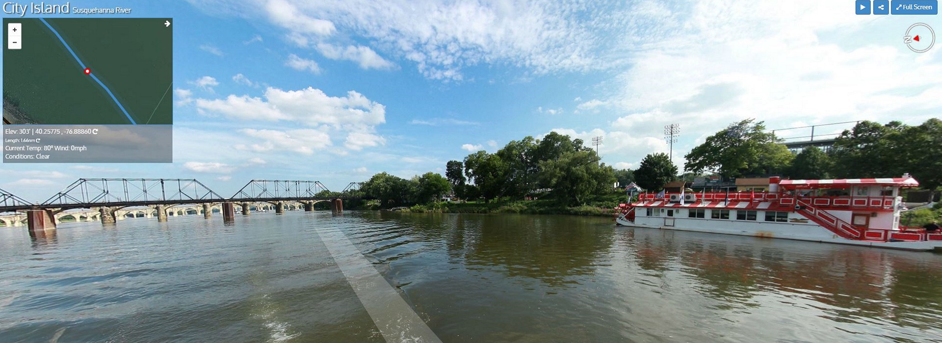 Susquehanna River, allowing viewers to interact with the river virtually, exploring its geography, recreational amenities, and ecological resources through their computer, phone, or tablet.
The virtual tour, which shares the perspective similar to what a kayaker might see first hand while paddling down the Susquehanna River, highlights access sites, flora and fauna, and important historic and cultural sites along the river. It is available on the Chesapeake Conservancy’s website at www.chesapeakeconservancy.org/apps/susquehanna/.
“The mighty Susquehanna is an ancient river that is full of history, wildlife and adventure. It also provides nearly half of the freshwater entering the Chesapeake Bay,” Chesapeake Conservancy President and CEO Joel Dunn said. “While making the Susquehanna virtually accessible to everyone, we also want to inspire people to visit the unique natural and historical resources and become stewards of the river to protect it for future generations to enjoy.”
Earlier this summer, in conjunction with its Envision the Susquehanna partners, the 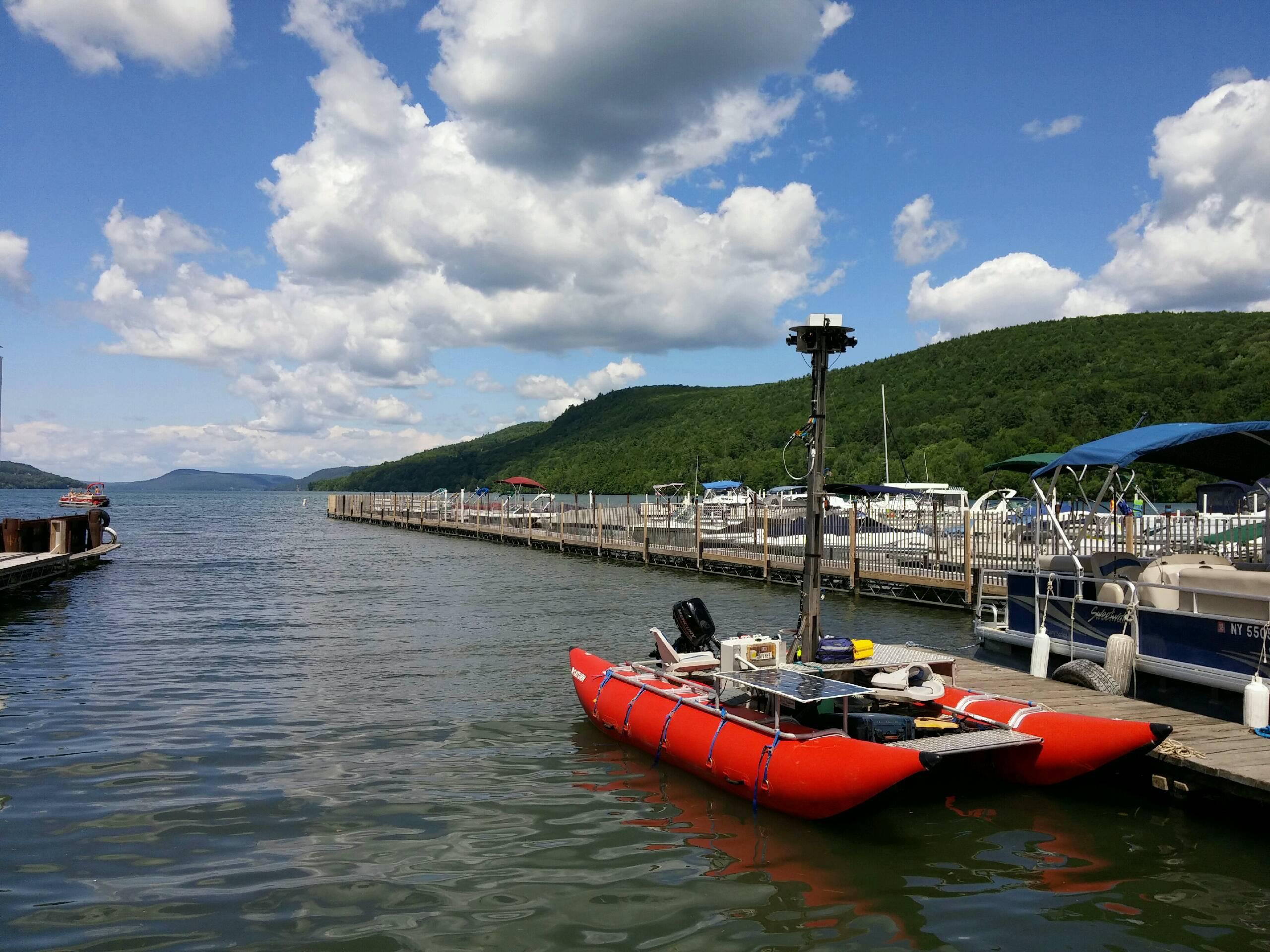 Conservancy and Richmond-based Terrain360 deployed a one-of-a-kind handmade boat, equipped with six cameras mounted 10 feet above the water’s surface to capture high-resolution, 360-degree images every 50 feet. Terrain360 built and operates the pontoon and stitched the images together to create a digital image map of the Susquehanna.
Flowing from headwaters in Western Pennsylvania and Northern New York, the Susquehanna River drains more than 27,500 square miles of land before reaching the Chesapeake Bay in Maryland. American Rivers has named the Susquehanna one of America’s most threatened rivers twice in the past decade.