Working in cooperation with the Pennsylvania Game Commission, the Department of Conservation and Natural Resources is rolling out an expanded interactive map that adds state game lands to a website already increasingly popular with hunters and other visitors to state woodlands.
“This information is timed perfectly, as state hunting and antlerless deer licenses go on sale Monday across Pennsylvania,” said DCNR Secretary Cindy Adams Dunn. “Hunters now can find invaluable information to plan their outings to both state forests and game lands.”
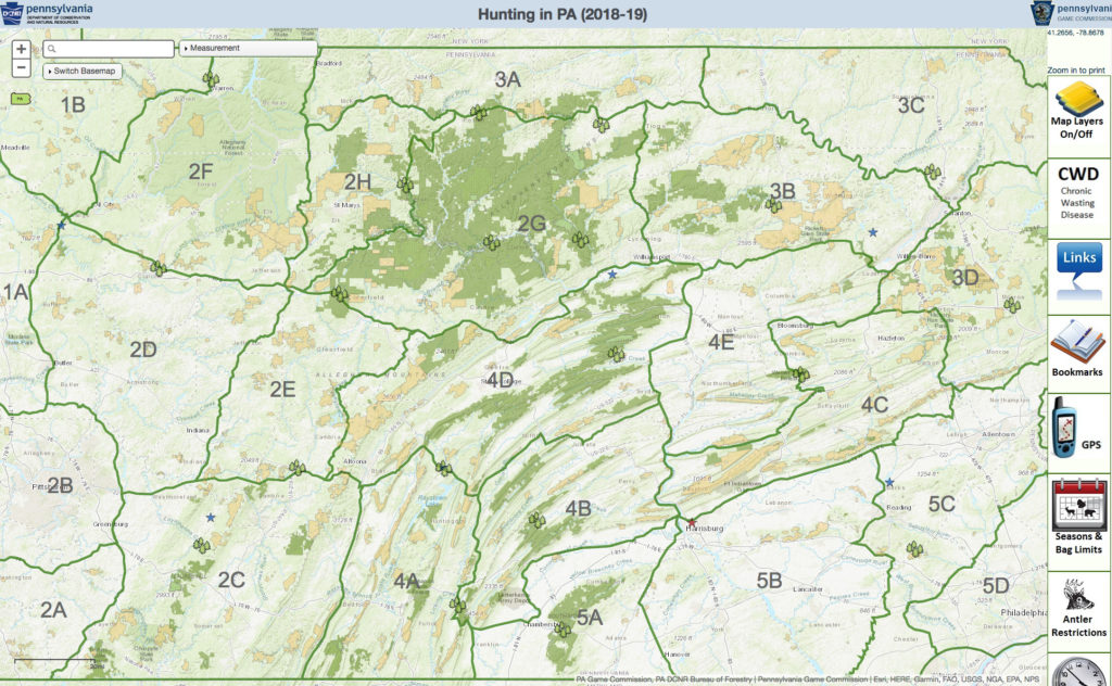
The map shows viewers areas of timber harvests and various habitat types as well as state forest boundaries and DMAP areas approved by the commission. Other map overlays include bear check station locations, elk management zones, and normally gated roads that will be opened in the fall.
The website is geared to be an invaluable tool for hunters seeking prime locations for a variety of game, but is also useful for anyone planning a visit to state forest districts or game lands.
In addition, the site lists hunting season information, deer harvest statistics, and legal hunting hours. The map also features GPS and mapping measurement tools enabling hunters and others to find the best routes on state forest lands to areas they may want to hunt or visit.
“It’s all there at Hunting in PA,’’ Dunn said. “Whether you’re an archer planning to open your season on state game lands, or a fall foliage fan looking forward to trips into our state forests, this website is brimming with information on roads recently opened, forestry office contact numbers, even links to weather and prevailing winds.”
More than 101,000 acres of DCNR land has been approved by the commission for participation in its Deer Management Assistance Program (DMAP) during 2018-19. Hunting map users can also find information on DMAP permits available, as well as details on the 15 participating state forests and other essential information.
Three new state parks are participating: Caledonia, Cowans Gap, and Pine Grove Furnace. Others are: Bald Eagle, Beltzville, Blue Knob, Canoe Creek, Codorus, Cook Forest, Gifford Pinchot, Hickory Run, Keystone, Kings Gap, Moraine, Nescopeck, Ohiopyle, Oil Creek, Prince Gallitzin, Presque Isle, Raccoon Creek, Ricketts Glen, Ryerson Station, Shawnee, and Tobyhanna.
The map can be viewed here. For more information on Pennsylvania’s 20 state forest districts, click here.