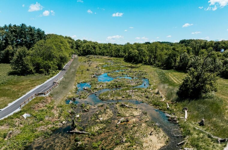
GIS & Mapping
WeConservePA researches, analyzes, and publishes geographic information in support of conservation.
We also provide a forum for creators and users of conservation-related spatial data and analysis.
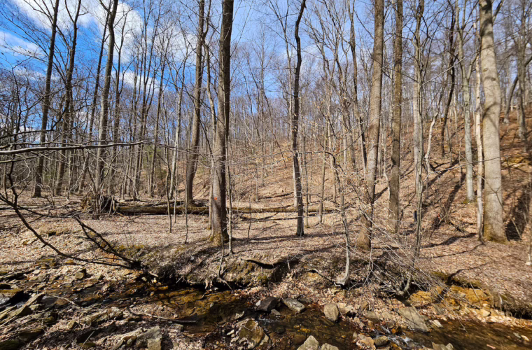
Conserved Land Database
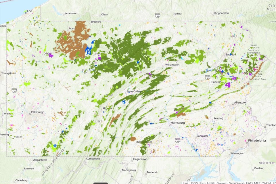
PA’s Official Spatial Database
of Conserved Land
WeConservePA compiles and maintains Pennsylvania’s official spatial database of conserved land, including privately conserved land and properties and those conserved by federal, state, county, and local governments.
Launch PACL Map Tutorial
Land Conservation Data Contribution
Contribute Data
Have new data to contribute? Spotted something inaccurate?
Whether you have data to add or feedback to share, you can reach out to GIS Analyst Irina Beal at ibeal@WeConservePA.org.
Please submit missing or new acquisitions or easements as a zipped shapefile or geodatabase through email, Dropbox, Google Drive, or WeTransfer.
Below are guidelines for attributes to include in your submitted data:
Fee Lands Fields
| Property Name: | | Full, public-facing name |
| Access Level: | | No Public Access / Restricted Access / Open Access. |
| Owner Name: | | Fee ownership |
| Manager Name: | | If different from owner |
| Establishment Year: | | Year the park or management unit was established |
| Acquisition Year: | | Year the parcel was purchased (entered in PACL as Year Protected) |
| Property Website: | | Website providing information about property |
Easement Fields
| Easement Name (public): | | Public-facing name, often generic or numerical |
| Easement Holder Name: | | Name of organization holding the easement |
| Access Level: | | No Public Access / Restricted Access / Open Access |
| Easement Type: | | Open space, forest, farm, historical, etc |
| Acquisition Date: | | Date of deed amendment or easement recording |
| Conservation News: | | News article celebrating this conservation achievement (optional) |
| Duration: Restrictions: |
| Length or end date of easement – usually this is “in perpetuity” | No restrictions (NR) or Withhold from Public (W) |
If a survey was completed for the project and the easements has exclusion areas, please include this document.
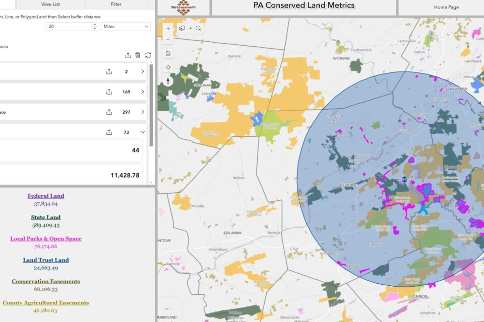
Conserved Lands Summary Metrics
This map provides the user with the number of and acreages of conserved land within the viewing window. It includes multiple filter levels to allow the map customization to depict user-specified land ownership and easement holders along with by county, watershed, and landscape.
Launch web map Tutorial
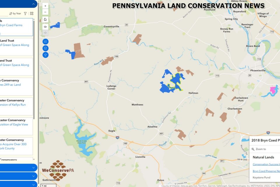
Conservation News Explorer GIS Page
Explore the conserved lands that have been featured in our Conservation News Updates.
Conservation News GIS MapRead Project & People News
Conservation Projects Blog Posts
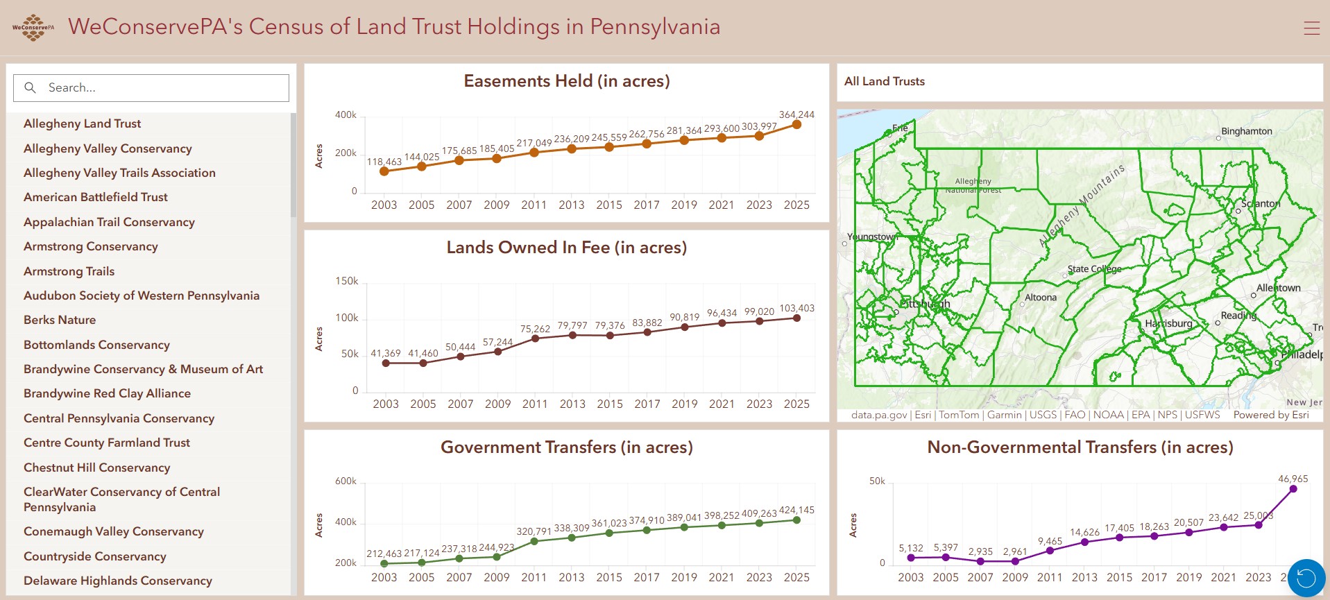
WeConservePA’s
Census of Land Trust Holdings in Pennsylvania Dashboard
Downloadable Maps
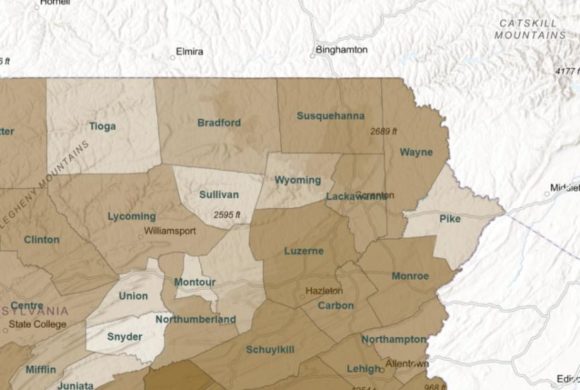
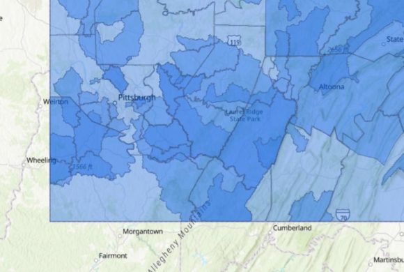
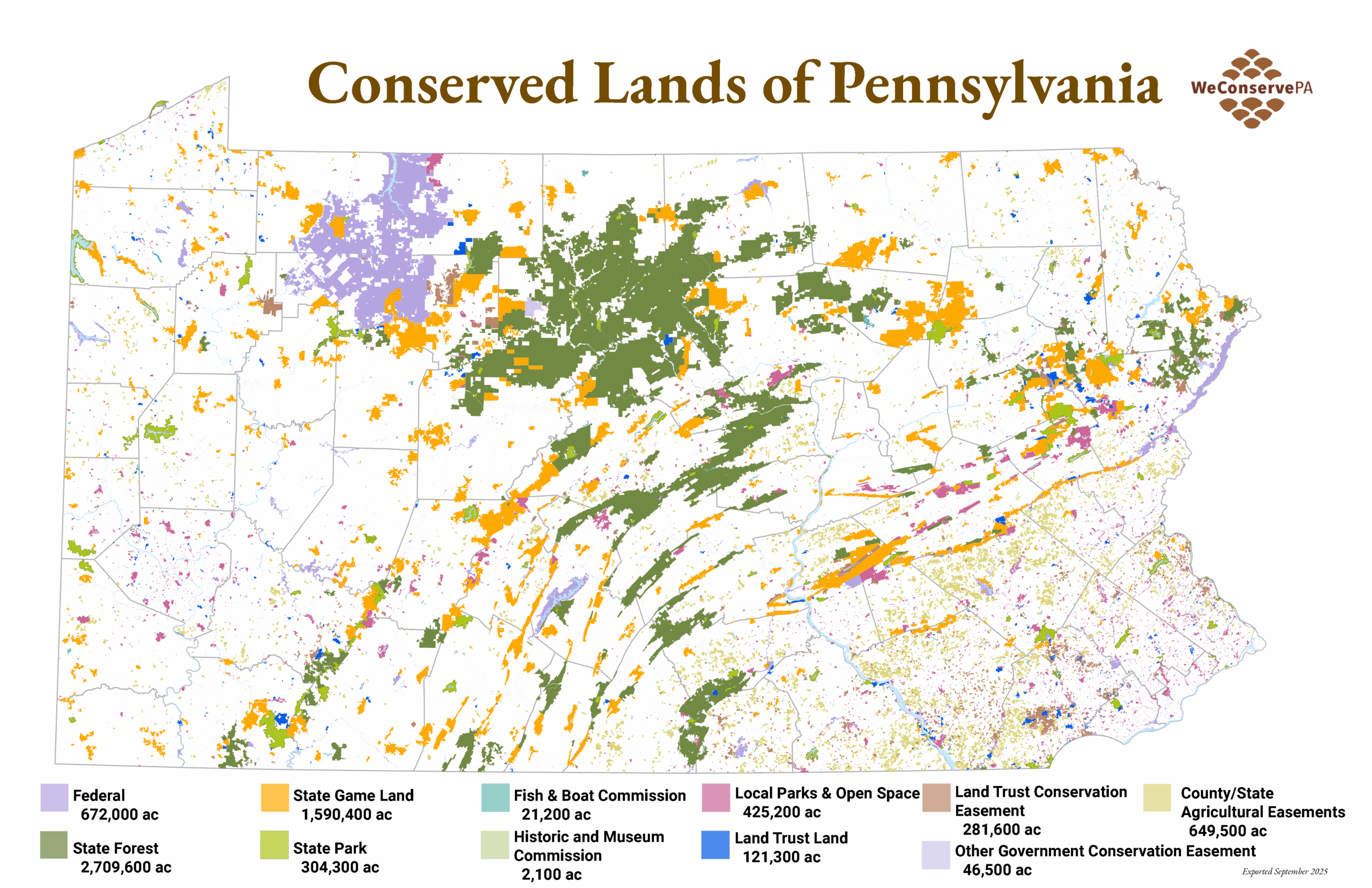
Conserved Lands of Pennsylvania
Percent Land by County
PA Regional Maps of Conserved Lands & Trails
Northwest | Northcentral | Northeast
Southwest | Southcentral | Southeast
ConservationAdvocate.org
Group Service Areas
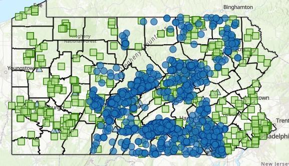
WeConservePA has mapped the service areas of land trusts, watershed associations, environmental advisory councils, and other organizations. We provide basic, intermediate, and advanced pathways for exploring these organizations.
Basic Exploration
For list view of land trusts, member organizations, watershed associations, trail groups, and environmental advisory councils please visit our Find a Group page.
Updates to Organization Profiles: For updates to your organization’s profile page or to add conserved properties, please contact Irina Beal, GIS Analyst at ibeal@WeConservePA.org.
Intermediate Exploration
Land Trusts
Find Pennsylvania statewide and regional land trust service areas by using the GIS map linked below.
Trail Groups
Find Pennsylvania trail groups by county, trail names, and recreation type (e.g. biking or hiking).
Watershed Associations
Find the service areas of Pennsylvania watershed associations by using the GIS map linked below.
Environmental Advisory Councils
Find Pennsylvania municipalities with active environmental advisory councils (EACs).
Advanced Exploration
To conduct advanced analysis regarding the service areas listed above, go to the District and Group Analyzer.
Find legislative district representatives who work in your area.
Find which land trust, EAC, watershed association, or trail group works in your area.
Return which group service areas overlap.
Legislative Maps in Pennsylvania
PA House District Map | PA Senate District Map | PA US Congressional Map
PA House of Representatives | PA State Senate | US Congressional Representatives
Learn more about redistricting
State Conservation Investment
Spatial Databases
Grants on the Ground
This map displays DNCR Community Conservation Partnerships Program Grants. This grant program, managed by the DCNR Bureau of Recreation and Conservation (BRC), builds connections between Pennsylvanians and the outdoors by supporting recreational improvements, natural resource conservation, and community revitalization efforts.

Keystone, Recreation, Park and Conservation Fund Projects
Displays and summarizes conservation projects funded specifically through the Keystone Fund.
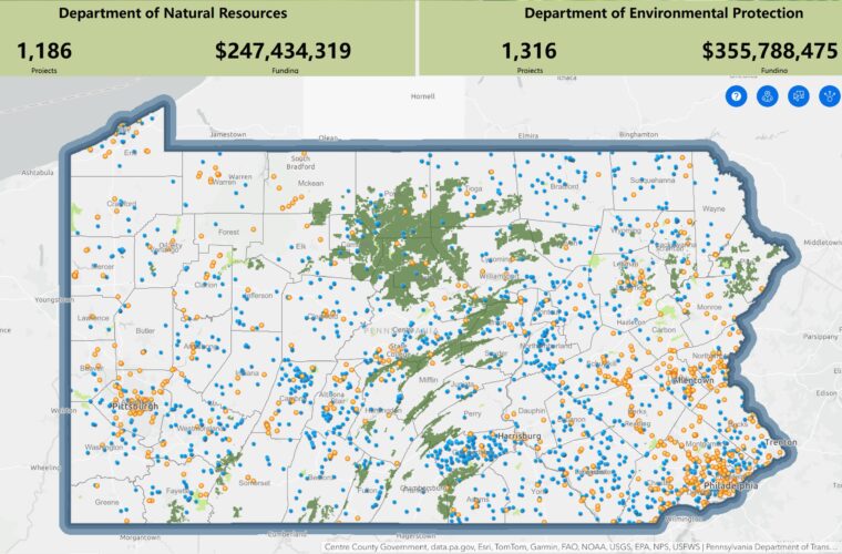
Environmental Stewardship
Fund Projects
Displays and summarizes conservation projects funded specifically through the Environmental Stewardship Fund.
Department of Environmental Protection Grants
Grants implemented by the Pennsylvania Department of Environmental Protection including Countywide Action Plan grants, Growing Greener grants and EPA Section 319(h) grants.
Mapping & Analysis
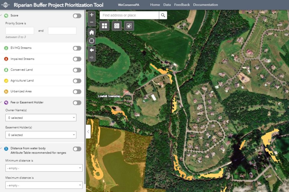
Streamside Tree Planting Opportunities and Prioritization for PA
Where is a good place to plant streamside forests to improve water quality? The answer could be “just about anywhere.” But some streamside forests benefit water quality more than others. This project combines high-resolution land cover data with soils, topography, land use, and climate data to evaluate more than 200,000 potential streamside forest planting opportunities across Pennsylvania.
Reports
VanBrakle. 2019. Identifying and Prioritizing Streamside Forest Planting Sites in Pennsylvania Using GIS. PDF
Beal. 2021. Identifying Riparian Zones in Pennsylvania using GIS and Connecting People to Projects. PDF
Launch Map Dashboard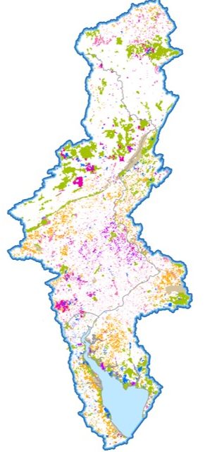
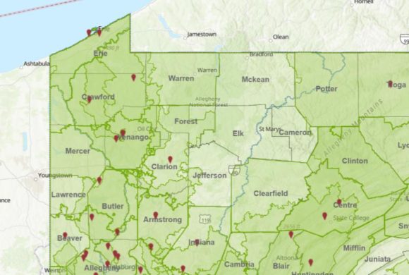
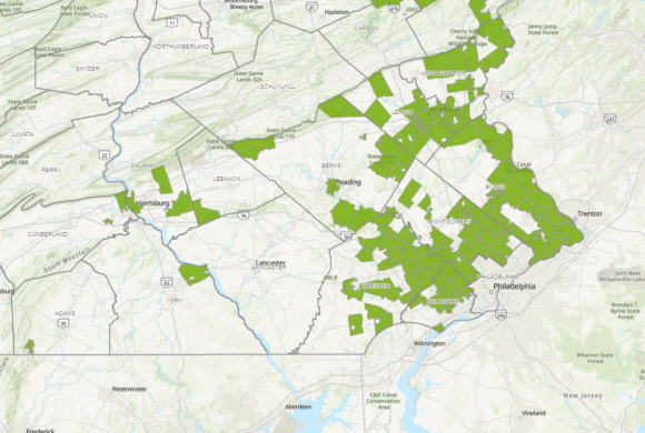
Delaware River Watershed Conserved Lands
An expansion of PA’s Conserved Land into the Delaware River Watershed, this map depicts lands protected by government and non-government entities through ownership and easements in Pennsylvania, Delaware, New Jersey, and New York. Funding for this project provided by the William Penn Foundation. Select the Dashboard button for an interactive experience.
If you wish to make improvements to the map, use the DRB Editor App or email the GIS Analyst.
Launch web map DashboardRead the 2024 report here.
Download the 1-page infographic summary here.
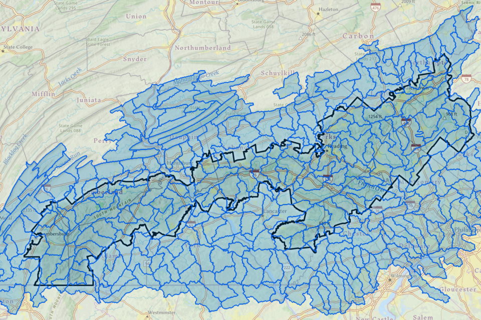
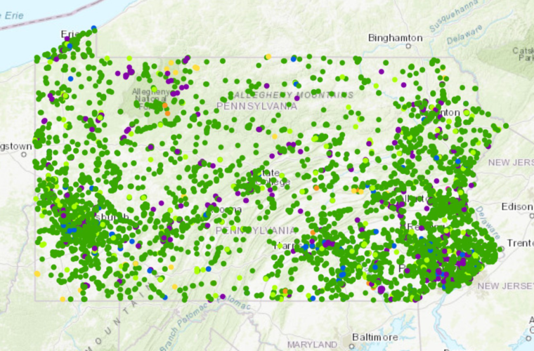
The Land Assessment to Conserve Water Resources in the Pennsylvania Highlands
Analysis conducted by the Appalachian Mountain Club
This project focuses on providing key resource information to protect a watershed’s ability to produce clean water by incorporating findings from the National Forests to Faucets 2.0 (F2F2) project, conducted by the USDA Forest Service (USFS), the Open Space Institute (OSI), and the Lancaster Conservancy. The goal is to support our partners in protecting forests to improve water quality through watershed analysis. In addition, environmental risk factors and other relevant data are included in an interactive online map. This map serves as a decision support tool, helping organizations enhance their conservation efforts.
Launch Map Read ReportIn partnership with DCNR
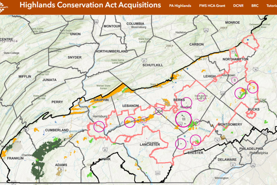
The Highlands Conservation Act (HCA) provides for the purchase and preservation of threatened lands in a four-state Northeastern corridor that includes NY, NJ, CT, and PA and is funded by U.S. Fish & Wildlife Service. Explore Pennsylvania’s projects.
Explore
Cell Coverage at Outdoor Recreation Sites in Pennsylvania
Planning a visit to a public park, forest, trail, or nature preserve in Pennsylvania? Curious if you’ll have cell coverage there? The maps show locations of public lands and trails in Pennsylvania, then overlay those places with cell coverage data. Mobile-friendly.
Explore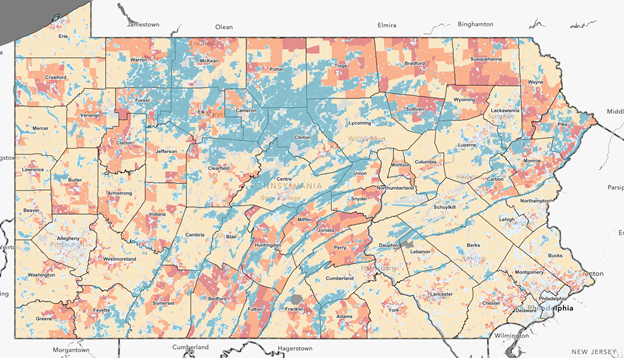
Outdoor Recreation Access in Pennsylvania
DCNR partnered with WeConservePA and The Trust for Public Land to determine who has access to outdoor recreation within 10 minutes of their home and, more importantly, who does not? The resulting interactive maps help identify gaps in access and opportunities to more equitably provide recreational access to Pennsylvanians.
ExploreData Resources
Pennsylvania Resources
Pennsylvania Spatial Data Access
![]()
Biota | Boundaries | Energy | Hydrology | Imagery | LIDAR & Elevation | Local Governments | NGOs & Academic Organizations | Parcels | Recreation | Transportation
Pennsylvania Department of Environmental Protection (DEP) Resources
![]()
The Digital Water Atlas
PA Department of Environmental Protection
The intent of this atlas is to lay out the landscape of Pennsylvania’s water and land resources and how they are managed. It is also intended to help people understand where our water comes from and how it is affected by natural events and human activity, which is the first important step towards water planning.
DEP GIS Mapping Tools

Environmental Justice Areas Viewer | Geographic Information Systems (GIS) Mapping Tools
PA DCNR Open Data

PA DCNR Open Data: This site provides access to all of DCNR’s published GIS data, which includes over 130 datasets relative to state parks, state forests, geology, recreational opportunities and more.
PennDOT Spatial Data Portal

Aviation | Boundaries | Bridge | Facilities | Projects | Railway | Roadway | Safety
Penn State University Libraries: Maps and Geospatial: Overhead Maps

Statewide Resources: Pennsylvania Spatial Data Access (PASDA) Imagery Navigator | Pennsylvania Spatial Data Access (PASDA) Imagery Navigator Video Tutorial | Penn Pilot | Pennsylvania Geological Survey Library | Pennsylvania State Archives | Penn Pilot Centroid Atlas | Vintage Aerial Photos

Conservation Opportunity Area Tool
Pennsylvania Natural Heritage Program
![]()
Pennsylvania Conservation Explorer
U.S. and Regional Resources
USGS Landsat Data Access Portals

EarthExplorer | GloVis | LandLook | ESPA On-Demand Interface | AppEEARS
Chesapeake Bay Program

Data Programs: Modeling | Monitoring | Resource Lands Assessment
EnviroAtlas
![]()
Multi-Resolution Land Characteristics Consortium

NLCD Land Cover Change Index | NLCD Land Cover All Years | NLCD 2016 Land Cover
National Park Service

Boundaries | Campsites | Cultural | Elevation | Facilities | Forestry | Geology | Hydrology | Points of Interest | Marine | Soils | Trails | Transportation | Vegetation | Water Quality
REGRID
U.S. Department of Agriculture
Geospatial Data Gateway | Web Soil Survey
The Nature Conservancy (TNC)
![]()
Resilient Land Mapping Tool | Northeast Habitat Map – in partnership with Nature Serve
The Trust for Public Land (TPL)

Western PA Business Plan for Restoration of Healthy Forests and Freshwater Habitat | 10-Minute Walk Tools and Gallery | Outdoor Recreation Access in PA, Goal: Recreation for All
Learning & DIY
ESRI GIS resources

Esri MOOC Program (free online classes)
QGIS
![]()
A Free and Open Source Geographic Information System: Create, edit, visualize, analyze and publish geospatial information. | PDF Link: WeConservePA tutorial | Get Started Using QGIS
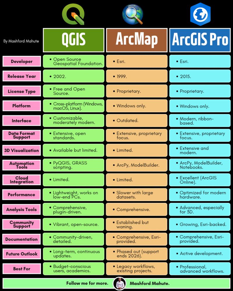
GIS Software comparisons – credit Mashford Mahute
Google Earth Pro

Google Earth Pro | How to Create a polygon in Google Earth Pro | How to Organize, save and tour placemarks in Google Earth Pro
YouTube

ArcGIS Pro Quick-Start Tutorials | ArcGIS Pro: Tips and Tricks | ArcGIS Pro: Mapping and Visualization
Other Mapping Resources
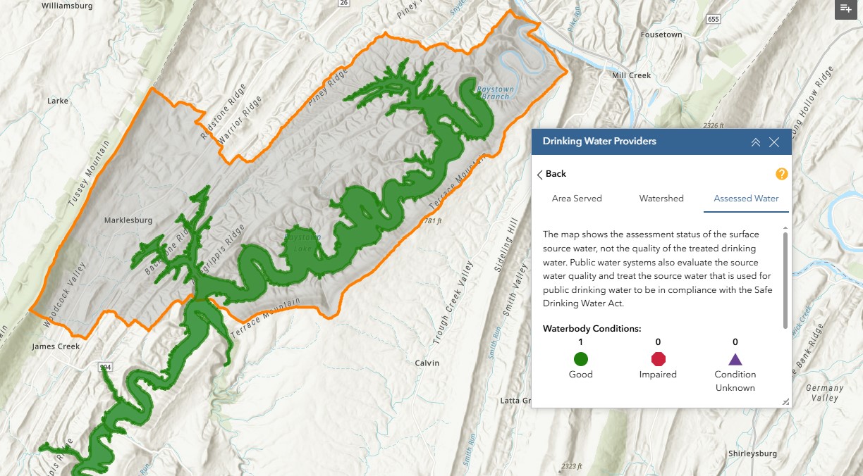
Drinking Water Mapping Application to Protect Source Waters
DWMAPS can provide drinking water professionals, source water collaboratives, watershed groups, and others with information to update source water assessments and prioritize source water protection measures in any location or watershed in the country. Web Application
Penn State Data Center – Dashboards
ACS Education
ACS Income
County Data
Municipal Data
PA Municipal and Socioeconomic Dashboard
State and County Estimates
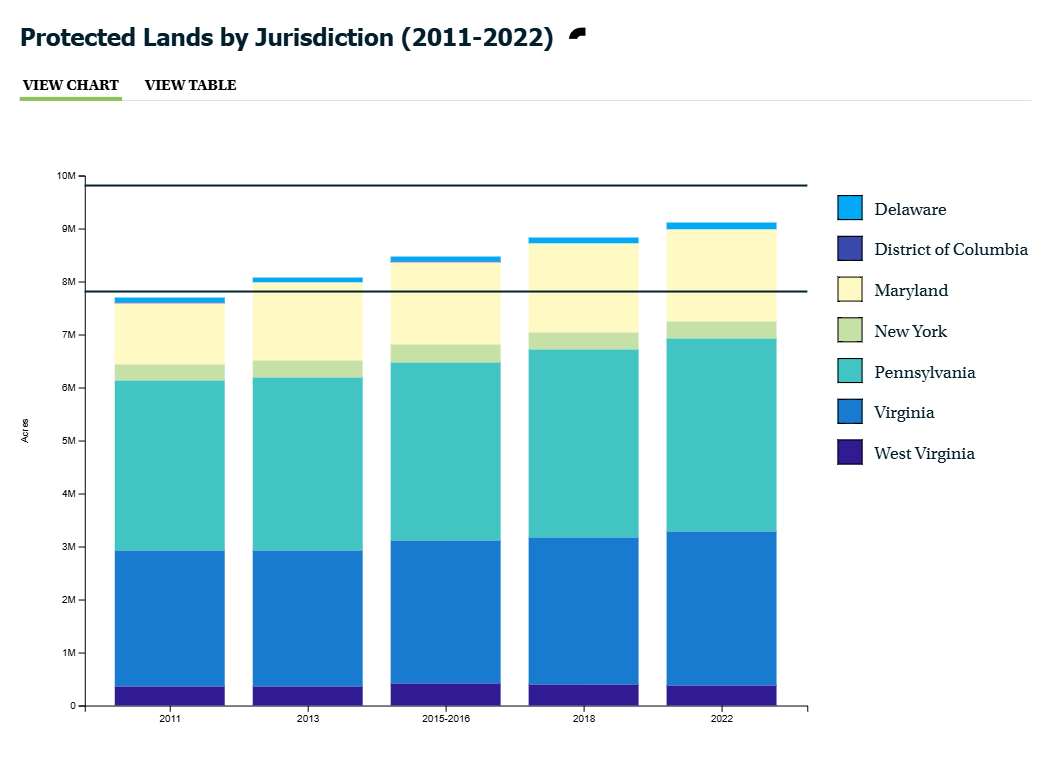
Chesapeake Bay Protected Lands
![]()
https://www.inaturalist.org/
Every observation can contribute to biodiversity science, from the rarest butterfly to the most common backyard weed. We share your findings with scientific data repositories like the Global Biodiversity Information Facility to help scientists find and use your data. All you have to do is observe.

Questions?
Irina Beal
GIS Analyst
ibeal@WeConservePA.org