by Irina Beal, WeConservePA GIS Specialist
As I was walking along the Dragon’s Back Trail in Tiadaghton State Forest, I noticed prominent white dots emblazed on the trees ahead. “I wonder if that is marking a property boundary,” I thought to myself. To check my hypothesis, I pulled out my cell phone hoping for cellular service, albeit not wishing to disrupt my immersion into nature. As the content aggregator and manager for WeConservePA’s Conserved Lands map, I knew just where to go – our GIS page and the PA Conserved Lands web application.
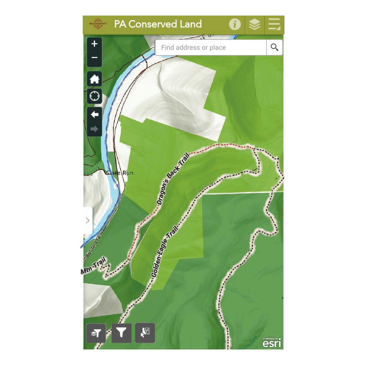 As I was out in the field and needed to know my exact location, I used the “Find Me” button that will use a phone’s or computer’s internal GPS to pinpoint one’s location. With the tap of that button (or widget as it is called in ArcOnline) the map panned to me. I had indeed crossed from the Tiadaghton State Forest Wolf Run Wild Area into State Game Land 68. It was indeed a visual representation of a boundary delineation to help hikers and hunters alike know that the property owner had changed.
The next order of business while I was there was to check that I was, in fact, on the correct trail. At the trail head from Route 414 is a sign indicating a 1.1 mile distance to the Dragon’s Back Trail and a 3.8 mile distance to the Golden Eagle Trail. As I had been hiking a ways and had not yet seen another trail sign, I wanted to confirm I was still on the correct trail as I was following the yellow blazes on the trees marking the path. When I turned on the trails layer on the map (the widget looks like a stack of papers in the upper right-hand corner), I was pleased to find that I was on the right track.
What I was surprised to find out, though, was that I had traveled up a different trail, the Quarry Mountain Trail, to reach the Dragon’s Back Trail. When I later checked AllTrails, it includes this section in its 7.1 mile total length (3.55 miles out and back, plus a 944 foot elevation gain). On my map, however, I was able to see that the Quarry Mountain Trail covered 1.2 miles with four switchbacks before joining the Dragon’s Back Trail following the ridgeline.
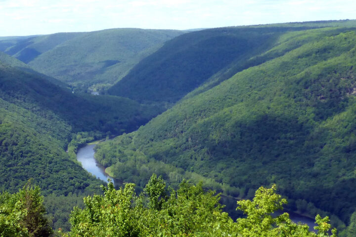
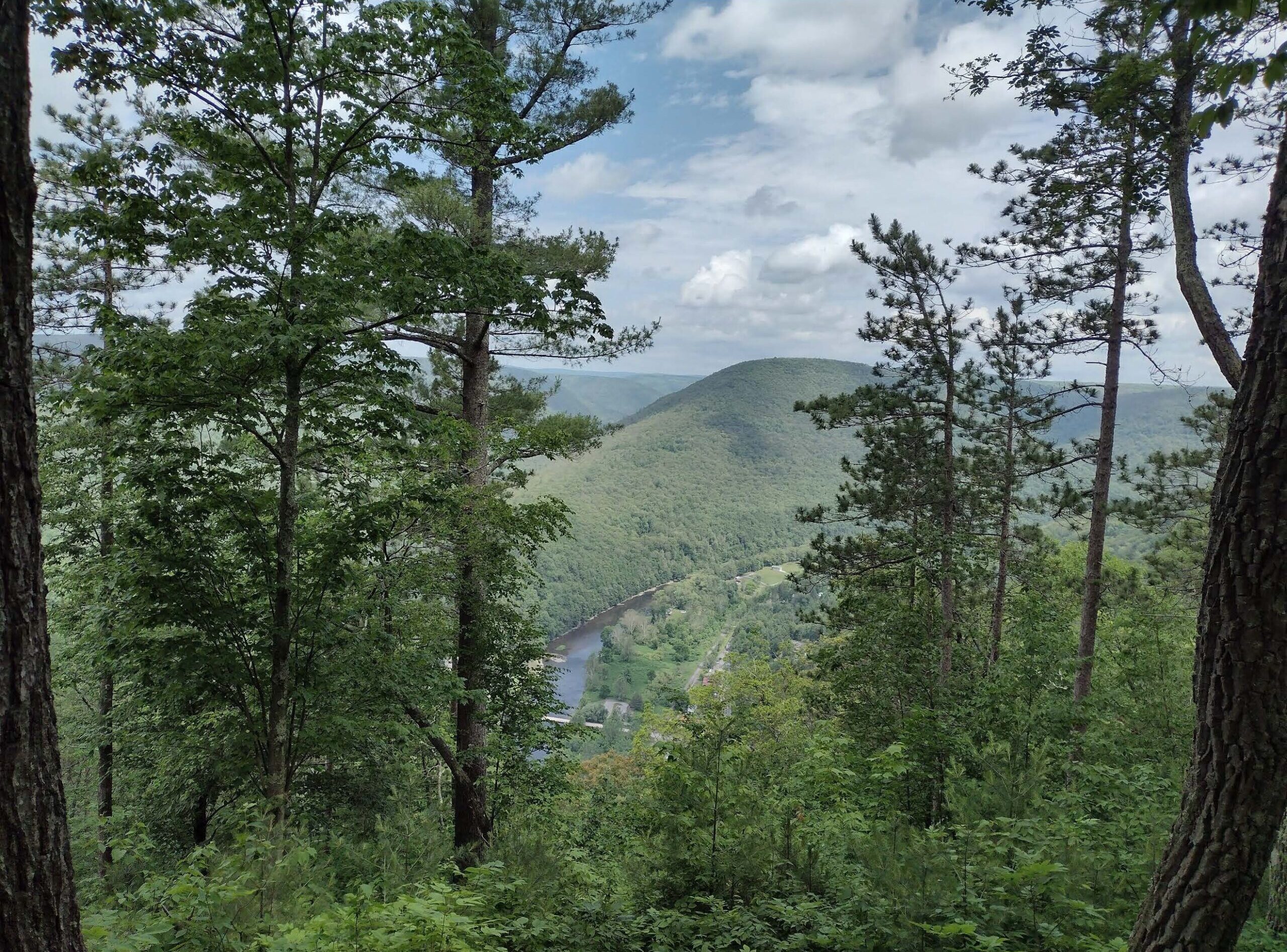
Once along the ridgeline it was smooth hiking along a rock- and root-free path with birds sounding their call. I even spotted Pennsylvania’s state bird, a Ruffed Grouse. When I came to my first view, Webber’s Vista, I stood in silence in awe of the view before me – a bend in Little Pine Creek with the mountainous terrain rising from the riverbed. The town of Slate Run lay beneath me and I was tempted to say, “I can see my house from here,” even if not true.
Webber’s Vista.
Now that I knew where I was along the trail, and how much lay ahead of me, I decided to turn around for now as I had only planned for a two-hour hike. The steep downhill of Quarry Mountain Trail was not kind to my knees, and so I had a slower pace going down than up. This was due to an increase in caution as I did not wish to collapse a knee nor tumble down the steep side of the mountain. As I carefully placed one foot in the ideal location in front of the other, I thought of how having this web application in the palm of my hand, and knowing about it, allowed me to not only better discover my location, but the surrounding area as well. The online map allows for multiple basemaps including aerial and terrain, and layers such as trails on State lands, local parks, and land trust preserves. As I have worked with this dataset sitting in front of a computer, I was now reaping the rewards of my work. The map maker had now become the map user.
To all those hiking, biking, or out enjoying nature, sometimes the little computer inside your pocket can bring more context to the world around you. Remember to take only photos, and leave what you find for others to enjoy.
If you wish to explore for yourself, check out: